Susquehanna River: Part 3 - Fort Hunter to City Island
*Originally published September 2024.

Two years after surviving our epic trip down the Susquehanna River, I was itching to get back on the water. So much so that in the winter of 2024, I went and bought five used kayaks. Greg and I knew that if we were to go down the mighty Susquehanna again, we’d want our own gear. And we’d go much lighter this time, taking only the most essential items. If you recall, we hauled a TON of gear on our first trip.
We started making plans in the spring for a mid-summer trek, departing from Fort Hunter, cruising past City Island and working our way south to Goldsboro or further down the river. But the best laid plans can’t account for our busy work schedules nor the weather, both of which conspired against us all summer. By Labor Day, I made the decision to make the next leg sans Greg and travel instead with my wife and my summer intern.
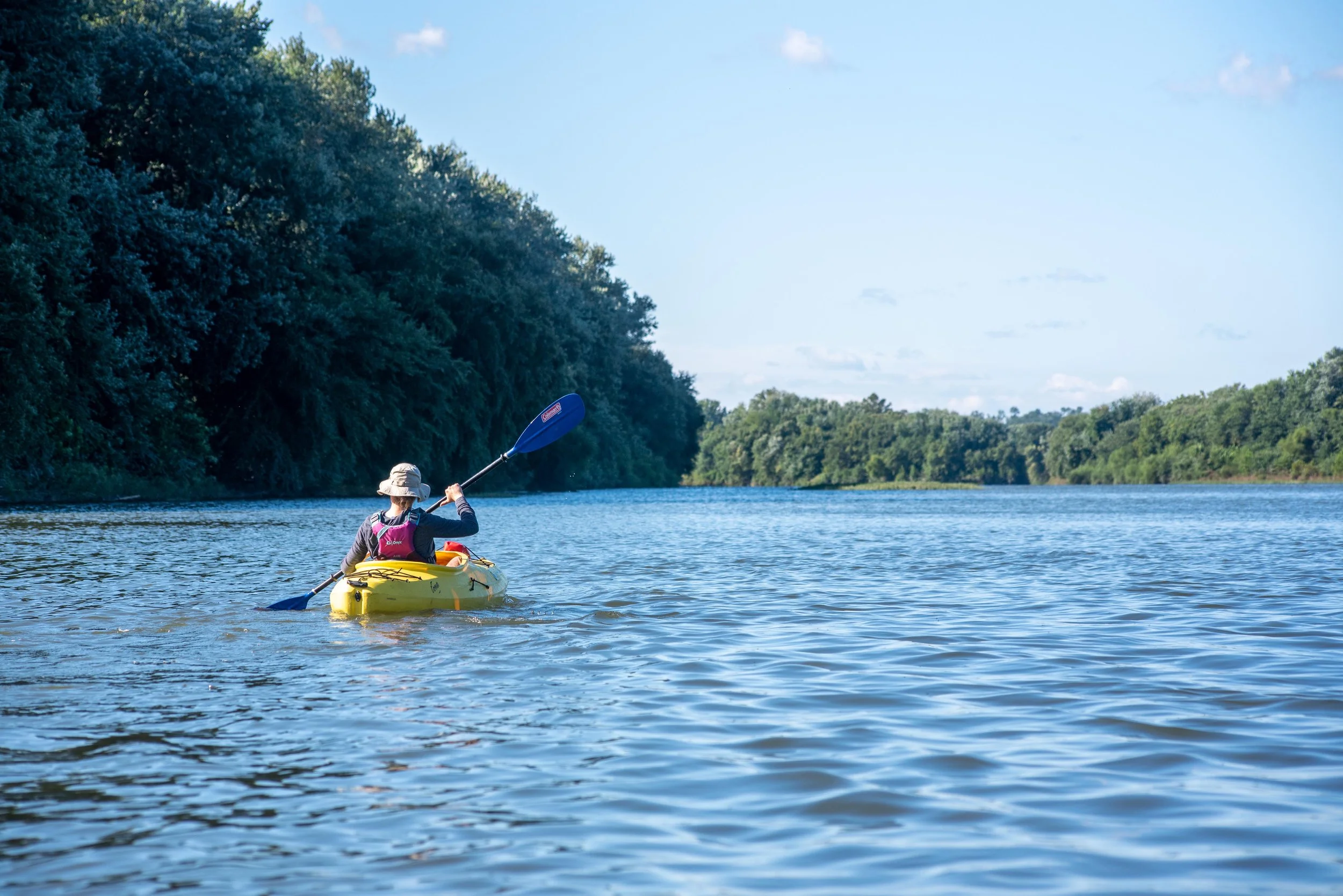
We lucked out with the weather and found ourselves at Fort Hunter on a warm and sunny morning. We put into the water and quickly found ourselves passing beneath the Rockville Bridge.
Construction of the bridge began in 1900, after previous bridges from Marysville failed to facilitate the increasing rail traffic during the height of the industrial revolution. Over the course of two years hundreds of stonemasons and laborers, alongside massive excavators and earth-movers, constructed the bridge from sandstone blocks. The bridge spans nearly 3,400 feet across the river in a series of forty-eight arches, which were built using falseworks (much in the same way the Roman aqueducts were built) to support the arches during construction and were removed upon completion.
To our delight, a long train came winding down from the north to cross the tracks as we passed under.


The excitement of industry and engineering behind us, we continued on with a stiff wind at our backs and soon reached the north end of the Sheets Island Archipelago. A series of small islands dot the river through the Harrisburg city center. I-81 crosses the north end of the largest island: McCormick. The island bears the name of the Mayor of Harrisburg in the early 1900’s, Vince McCormick, but was a major encampment for early native peoples. The island is littered with artifacts that have been buried by successive floods over thousands of years.
But the island is an important wildlife sanctuary as well. Birds like herons, egrets, eagles, loons, mergansers, and grebes call the island home. In 2007, in an effort to conserve this habitat for these species, the Central Pennsylvania Conservancy purchased the island from the city, though it is still open to the public. A neighboring island, Wade Island, is off-limits to the public and remains a wild habitat for migratory birds and waterfowl.

We pressed on along the west shore of McCormick Island. I wanted to swing further west to explore some of the islands on that side of the river and we attempted to cross the channel. The wind, our friend at our backs and along the islands, became our enemy as we entered open water. My intern (a member of the rowing team in London) and I struggled to get across the channel, but were just able to make the north end of Wade Island. My wife could not. The wind pushed her further downstream faster than she could cross. My intern and I rounded back upstream against the wind and the current to come around the north end of the island. We stopped in the water along the shore for a snack of cheese and sausage, but the wind continued to drift us downstream. We were forced to abandon our repast and get back to paddling.
Leaving Wade behind, we headed southwest towards Sheets Island and its subsidiaries. The warm late-summer sun was high now and cormorants were out basking on the rocks. Hunters were deploying decoys just north of the mouth of the Conodoguinet.
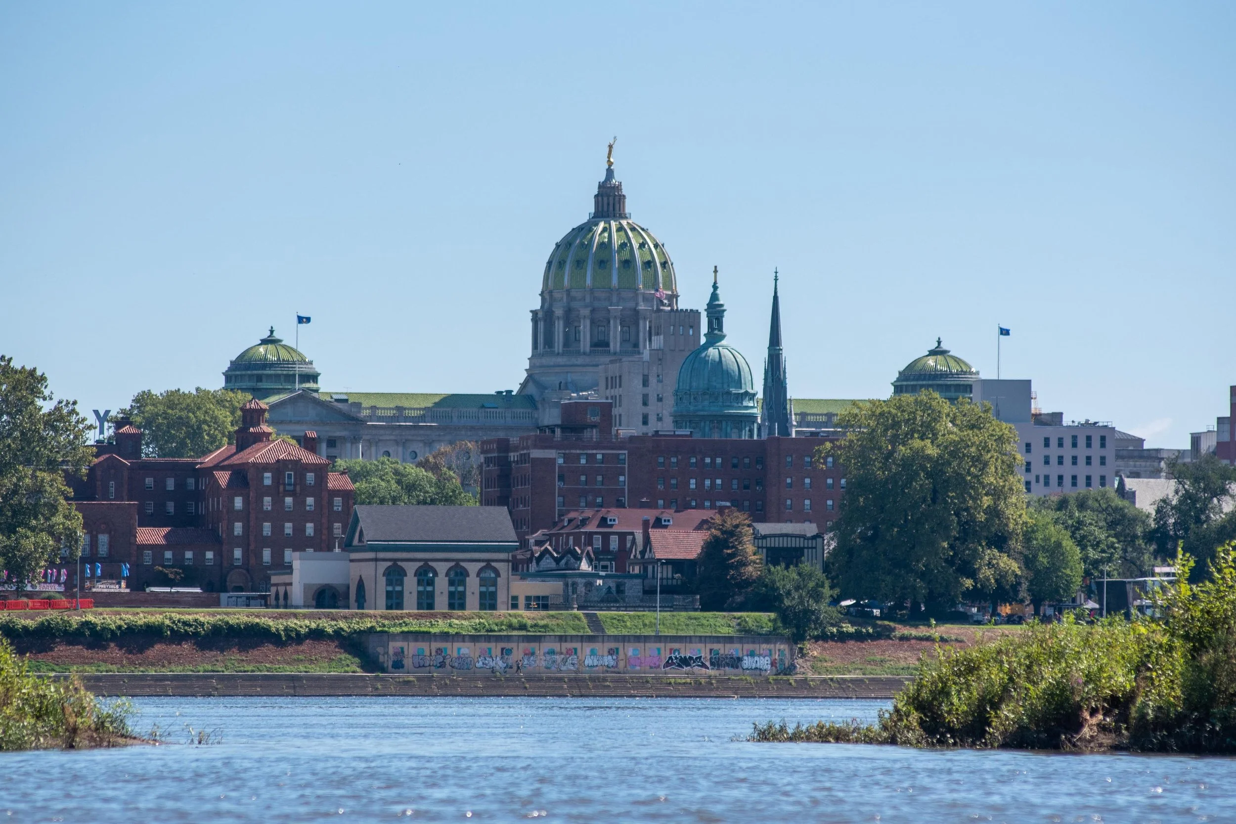
Crossing under Forster Street, the Pennsylvania state capitol building in Harrisburg came into view. It’s gleaming green and gold dome reflected the late afternoon light. The building was completed in 1906 and is both an architectural marvel as well as an artistic one.
As we reached the north end of City Island the water became slack, slowed by an eel dam downstream to facilitate water recreation around the island. It also meant that we were paddling harder at the end of a long run. We crossed under a myriad of old bridges, with many more south of us as we rounded the end of City Island, bringing our journey to a close.
There had been no great adventure. No lost kayaks. No over-expectations of our capabilities. Just a quiet late-summer paddle down a great river.
Thanks for following along. Stay tuned for more adventure!
-ET
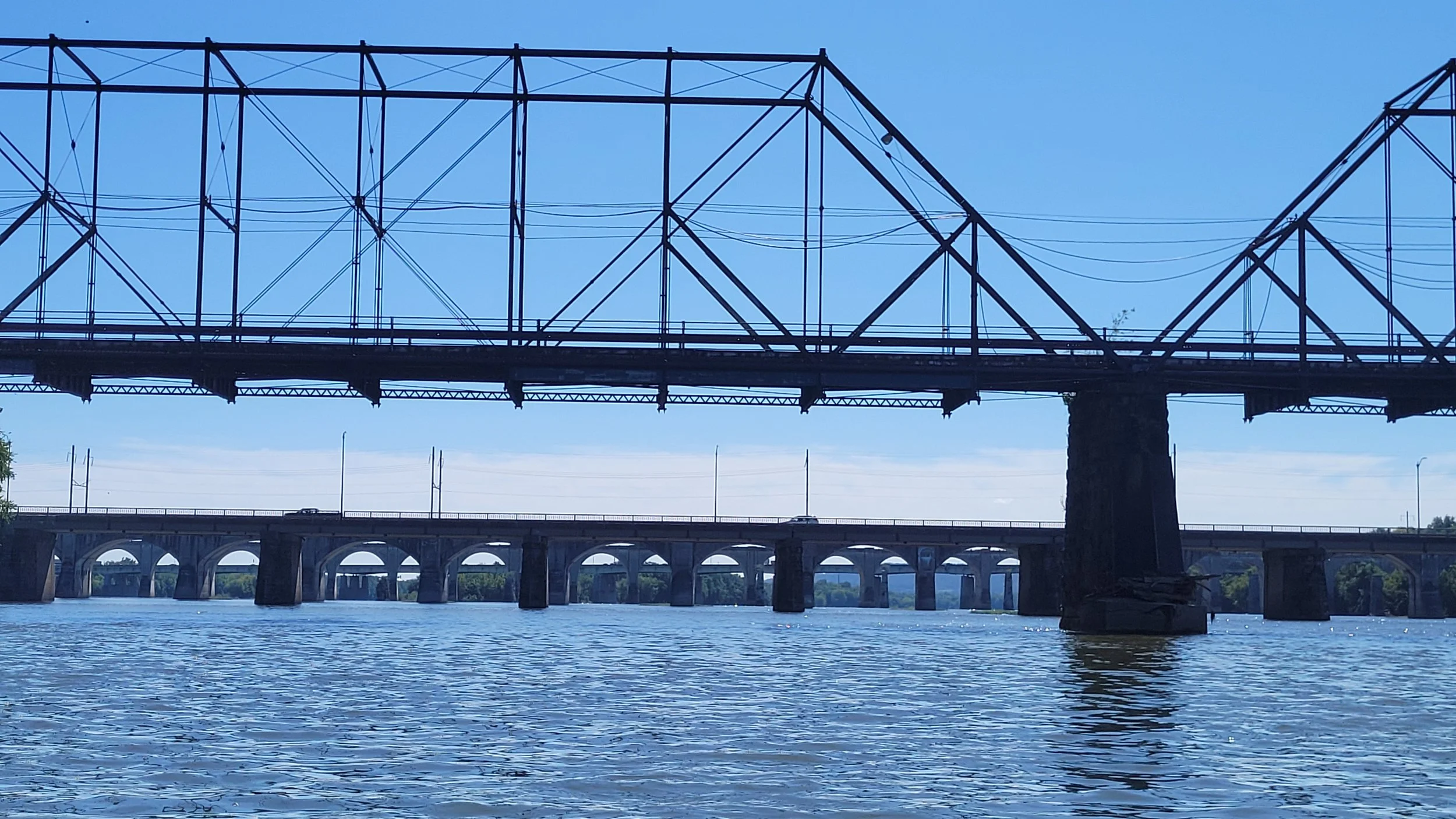
Land of many bridges.