Susquehanna River: Day 2 and 3 – Millersburg to Fort Hunter
*Originally published September 2022.

Day 2: Millersburg to Duncannon
We awoke at 06:00 the next morning. By our guess, we had gone to bed at 20:30. The aches and soreness that had fully engulfed us the night before had melted away. The mental and emotional fatigue that had plagued us the last hour of the night before was gone. We had made it. We were still not convinced that we would be able to execute the rest of the route as planned, and as such, we agreed to play the day by ear, with a focus on photography if we could. Perhaps Ed’s wife would be collecting us early. Greg is an avid rock-climber, so we expected him to be able to have the stamina for this trip more than Ed, who is an avid-not-do-anythinger. One thing was certain, we did not make 3 mph on the water. We didn’t even come close. What we figured would be an arrival by mid-afternoon took us the entirety of the day. Our water pace was something like 1.5 to 2 mph which was made worse by our frequent stops.
After some Advil and Tylenol, and with clouds overhead, we decided to take just cameras out on the boats and try to photograph birds. That was, after all, what we had set out to do in the first place. The islands north of us had had a fair number the night before and perhaps we could post up and get some good shots. We paddled up river a few minutes when we came across a number of geese and we benched the kayaks on some rocks.. Ed had moved the big lens to one of the dry bags to make it more accessible for this portion of the trip. As he removed it and got set to take some pictures, a voice called out.
“Hey would you guys mind moving?”
We both looked around. It was 07:00, and there was not a single person in sight. We scanned horizon to horizon. Finally, the reeds ahead of us parted and a hunter, in his blind and camo’d out, poked his head out.
“Don’t want ya in my shot is all.”

We obliged him the same way a squirrel darts out of the road: in a haphazard manner of “Yessir, you got it”, flailing paddles, and made a quick escape. We went around the island back south and up the west side of ours to find a spot that was quiet and seemingly devoid of more Elmer Fudds. We saw no birds and made back for camp. We patched the leaking rivets on Big Yellow with duct tape, we had a breakfast of Taylor Ham and cheese on bagels, packed the camp, and got in the water at 09:00.
The morning was still very cloudy for which we were happy because our sunburned bodies probably couldn't take much more. A few minutes down the river, a juvenile bald eagle flew over us and circled. Ed pulled out the 500 mm lens and as it alighted on some rocks behind us, he got some great photos.
Eagle pics: check.
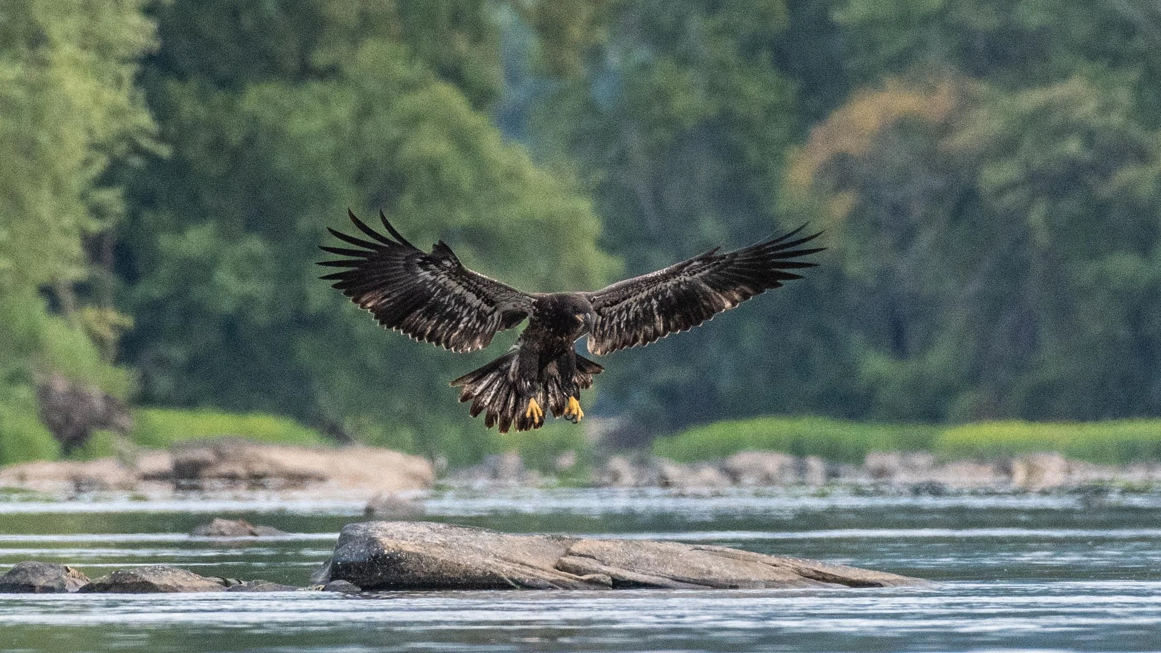
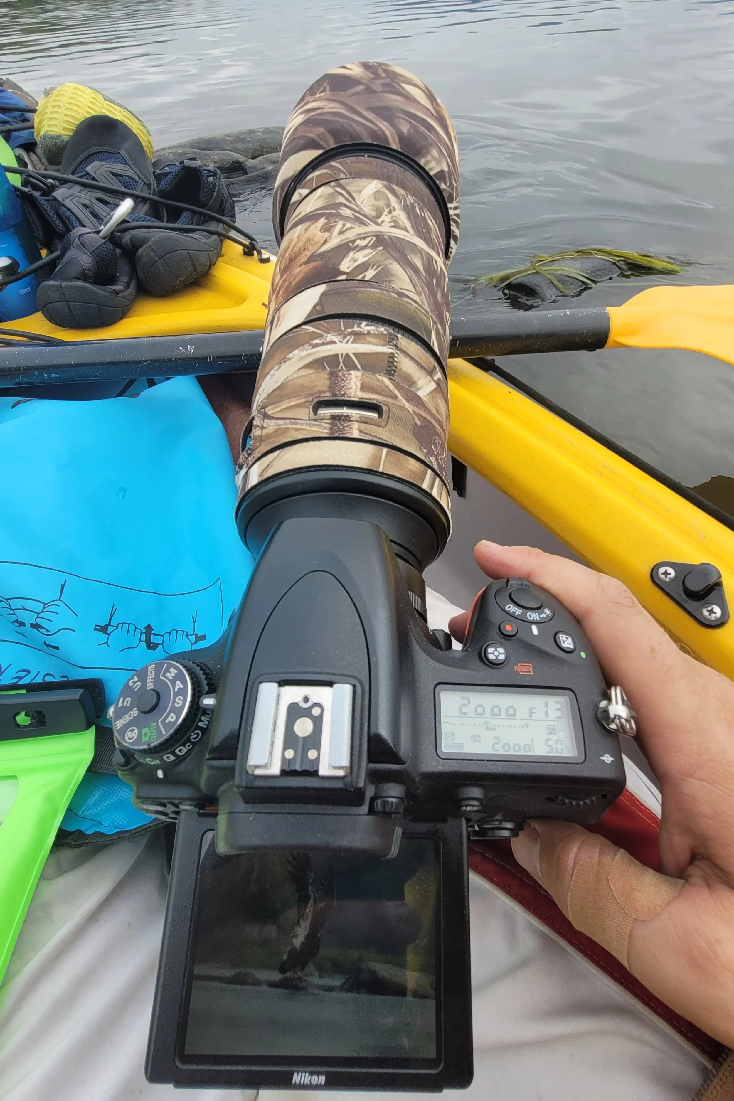

Bald eagles do not get their iconic plumage until they are between the ages of 3 and 5. Juvenile bald eagles are commonly misidentified as golden eagles, owing to the lack of the white head. This young eagle stayed there for about 20 minutes and we continued to creep closer upstream towards it. Photographing from a kayak that’s bobbing up and down on the water presents several challenges, the least of which is keeping your subject in focus and in frame at over 800mm. The weight of the lens without being supported by a tripod makes it even harder to stabilize. Ed rested the camera on the edge of the boat and used the live view instead of looking through the viewfinder. Satisfied by one of our main objectives of the trip, we turned around and prepped to go through the first true rapids at Hunter’s Run. We could hear a dull roar, almost a static din. Scouting ahead with the binocs, we could see several drops between the rocks.
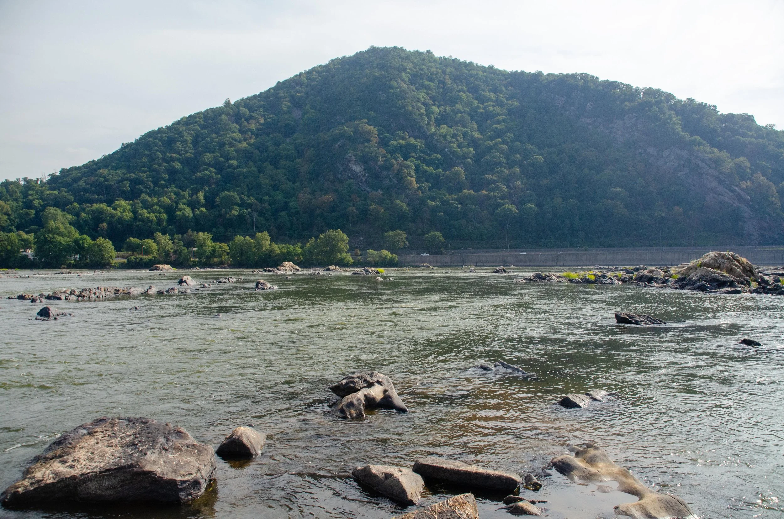
As the water gets channeled through the Berry Mountain Water Gap, a steep gradient with about 10 feet of drop is created. Toss in another sequence of Pocono Sandstone, and you have a recipe for some Class I rapids. A number of other kayakers, including some from Island 97, were joining us as we headed into the fray. After our first day on the water, we learned to read the river. Eddies and currents and ripples of varying sizes and in different places mean different things to the trained eye. We read the rapids very well, finding the most fun course with the fastest water. We reached a long, straight quiet stretch below and fell in peripherally to about a half a dozen other kayakers, which broke up and dispersed before too long.
By 11:30 we stopped just north of Island 93 and we were incredibly glad that we did not attempt to go on further the night before. Some snacks, another beer, a drone flight, and a water refill from the river with the filter were in order. The drone flight revealed the absolute beauty of the river. East of us there were a dozen or more islands in the channel, covered in a carpet of lush green reeds and grasses, dotted with purple wildflowers. Around these oases ran the choppy waters of the river. We departed, but it wasn’t long before nature put on another great show for us.

As we prepared to go through another small section of rapids, Greg spotted an osprey flying towards us, low above the water. In its talons it gripped a fish. Out of nowhere, a bald eagle swooped in and gave chase. The osprey dodged and turned, whirling in the air, taking evasive action. A second bald eagle joined in. We watched this aerial display in awe, wonderstruck by the drama playing out in the sky in front of us. At last, the osprey gave up its hard-earned quarry and flew off. The eagles landed and collected their reward.
We had the next three hours more or less to ourselves. The river quieted, but there were sporadic rapids and ledges that made the traverse fun. The water was deeper here and we found our pace a little better than the day before. Although it was cloudy, we had still slathered ourselves in sunscreen to atone for our sins the day before.
Just north of Clemson Island landing, a group of three middle-aged men walked down to the river as we approached. Feeling haughty, Greg called out to them.

Cormorant
“Hey! How far is it to Baltimore from here?”
The men chuckled, the one guffawed and pointed. “Keep paddling.”
“Ok thanks!”
To seal the ruse, Ed yelled to Greg. “See!? I told you we were way off!”
As we turned into the straight-away north of Haldeman Island, the water turned to a glass, still, but moving, as a sheet. Cloudy skies broke and gave way to abundant sunshine. The water deepened to about 4 feet. Although the Susquehanna is wide, it’s incredibly shallow.
At 14:40, near the south end of Haldeman Island, we stopped for a bit of cheese, more sunscreen, and some drink. We had been in the boats for three hours straight and it was good to stretch. We were only about 5 miles from the campsite, about two and a half hours if we kept up our pace. Plus, the thought of a beer resupply lifted our spirits.
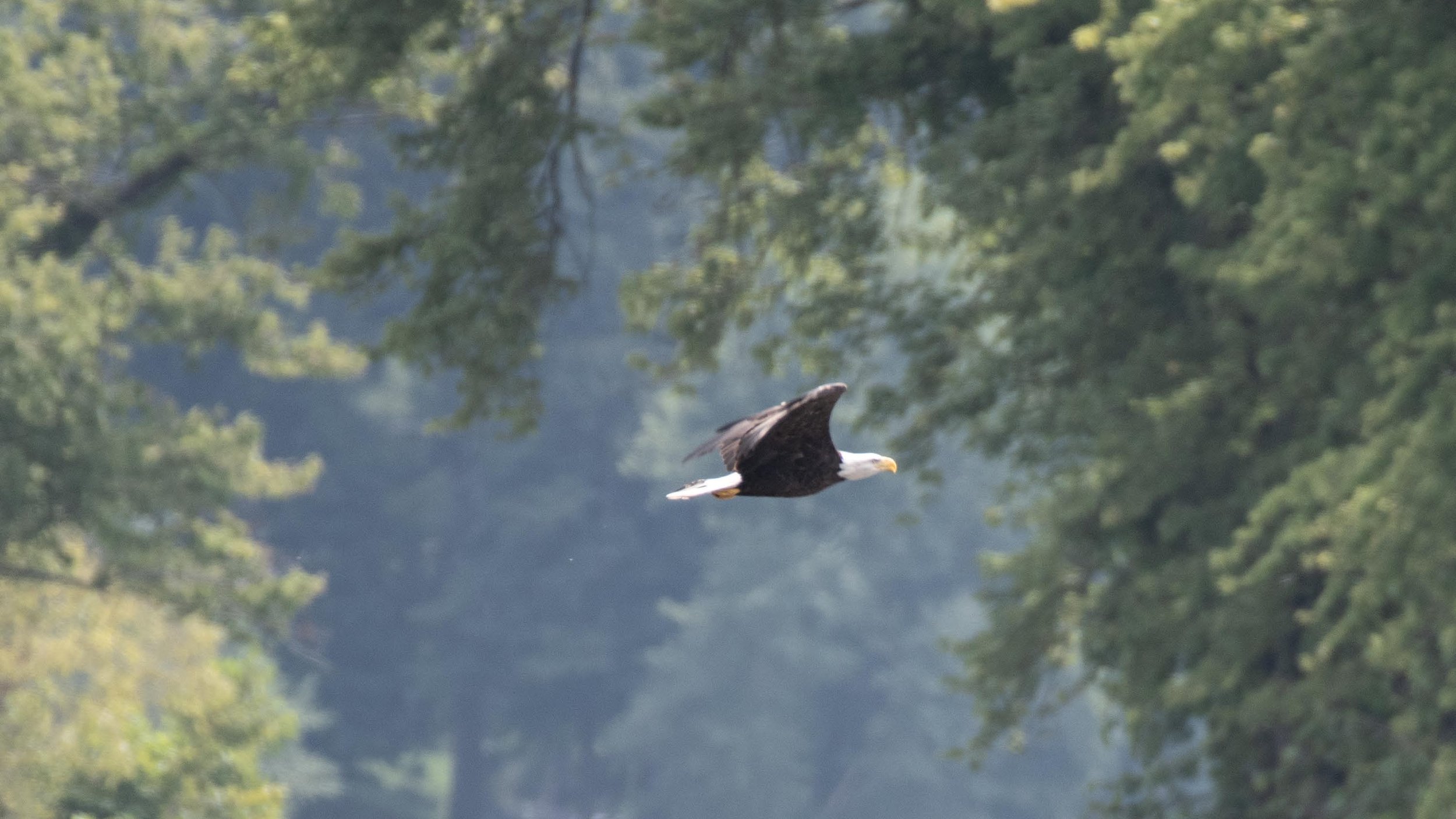
We came around the bend to find the Clark’s Ferry Bridge. We spotted more eagles, bringing our total to 9 for the trip. On the other side of the bridge, the Juniata River pours into the Susquehanna. But we plowed right into the center of the river, thinking it would be deeper there. We were wrong and once again, we found ourselves fighting shallows. Ed got turned sideways at one point, a dangerous position with a high probability of capsizing. He managed to break free and we moved river right into deeper water.

About 2/3rds of a mile from the beer store and salvation, Greg questioned our ability to reach the islands in the time frame that we expected to. After some discussion, we found the aptly named Riverfront Campground on the river at the confluence of the Juniata and Susquehanna right behind us. Ed called for a reservation.
“Hi, do you have any tent sites available for tonight?”
“Yep, I’ve got one. Where are you and what time do you think you’ll be here?”
“I’m in the river. I’ll be about 15 minutes.”
The man laughed and 15 minutes later we had secured a campsite right along the river. We portaged our gear inland, cleaned out the boats, repacked, made dinner, changed into some dry clothes, and then hauled all the gear back down to the water where we set up our hammocks.

Although the campground was not the nicest by any measure, our neighbors were really great people. They had done their fair share of paddling on the river themselves and were impressed with how much gear we hauled and how far we had come. It seems that most people don’t do multi-day river trips, or at least not with the kind of cargo that we had. They offered to get us things from the store if we needed anything. We bought a bundle of firewood from the proprietor, a grizzled man with a Duck Dynasty beard, and while Greg got the fire started Ed moved the last of the supplies to our boats. That’s when Ed heard him call out.

“Hey Ed. Come here.”
Greg had been unable to get the fresh wood to take a flame. Our neighbor, seeing his distress, came to the rescue. He broke out an old dandelion flamethrower and got our fire started. Ed spent the rest of the evening losing to Greg in rummy and fighting off mosquitoes until we called it a day.
We gifted our remaining firewood to our neighbors and they provided us with really great intel on the river down to Harrisburg. They told us which channels to take and what to avoid. We were pretty happy about this. A lot of the intel that we had gathered had been wrong or off prior to this. It was clear to us at this point that we would not make City Island by noon the next day. It was another 13 miles, and we had the Dauphin Narrows to contend with. Many accounts indicate that the water south of Marysville into Harrisburg slows down. We had discussed pulling off the river at Marysville, but our flamethrower-wielding neighbor suggested Fort Hunter instead. We decided that we would take his advice and climbed into our hammocks at 21:30.
Made good, no, great progress today. Long stretches of good navigable water, fun rapids.
Day 3: Duncannon to Fort Hunter.

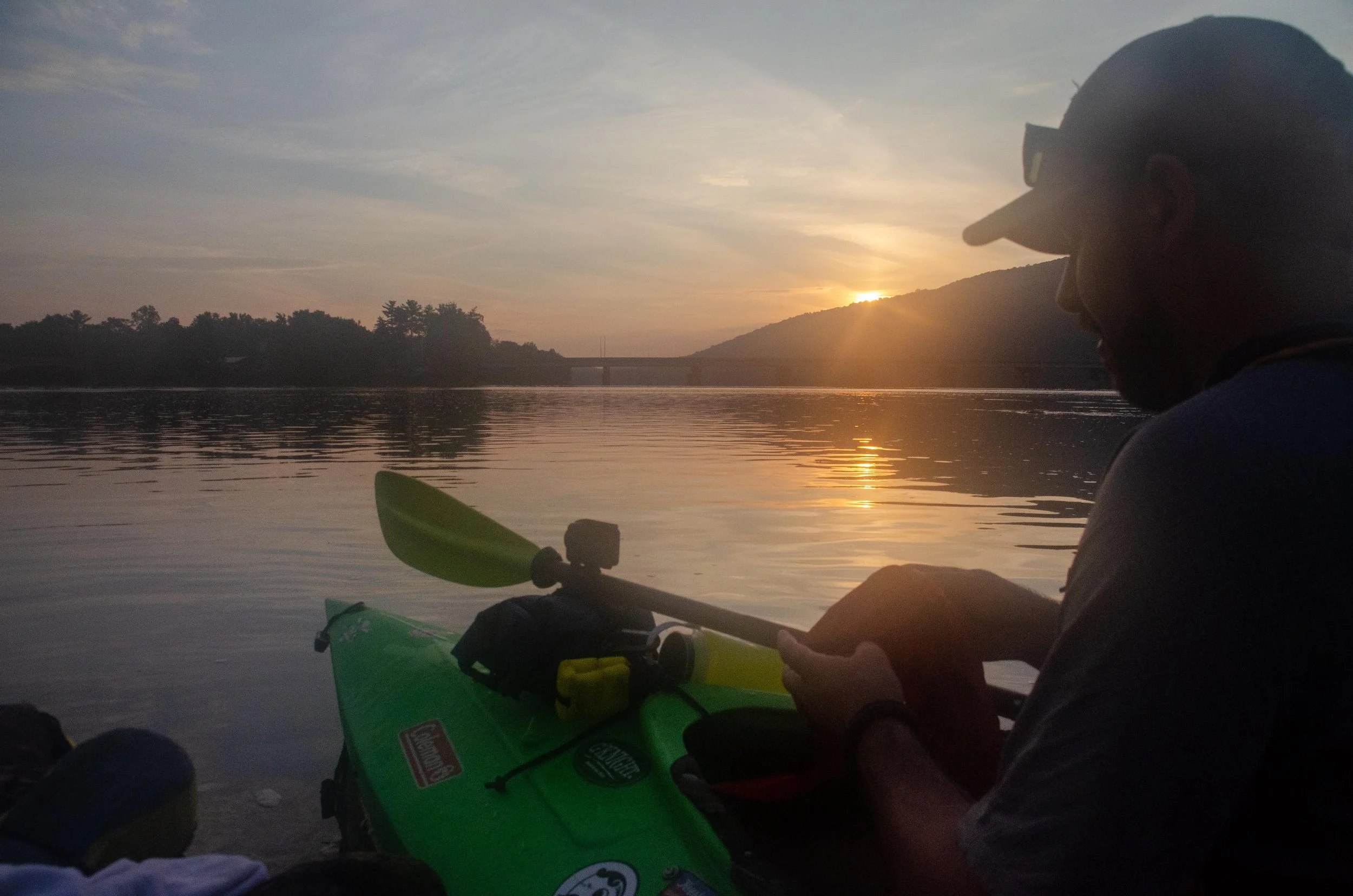
If the night before had been a deep, restorative sleep, the night in Duncannon was the complete opposite. The campground sits next to a main highway and a busy rail line. All night the sound of traffic, trains, and an incessant droning of insects disturbed our sleep. Ed awoke at 02:00 and managed to drift off again at 03:30. Greg startled him awake at 06:00.
We set up a time lapse, carted all our gear down to the river, made another breakfast of Taylor Ham and slightly warm cheese on bagels, stretched, and got into the water at 07:00. We followed the flamethrower man’s advice and cut across to the east bank straight away. There we found a swift channel that had been dredged for coal barges 40 years ago. We cut through several rapids as the alpenglow lit the western mountains. We made incredible time. We reached Island 82 by 08:00 and the end of the islands by 09:00, a pace of 2.5 mph. We saw more eagles on the west bank, bringing the total to 13. We reached the top of the Dauphin Narrows at 09:10. Our pickup was scheduled for 11:00 in Fort Hunter, just two miles from there. We had plenty of time to explore. Or so we thought.

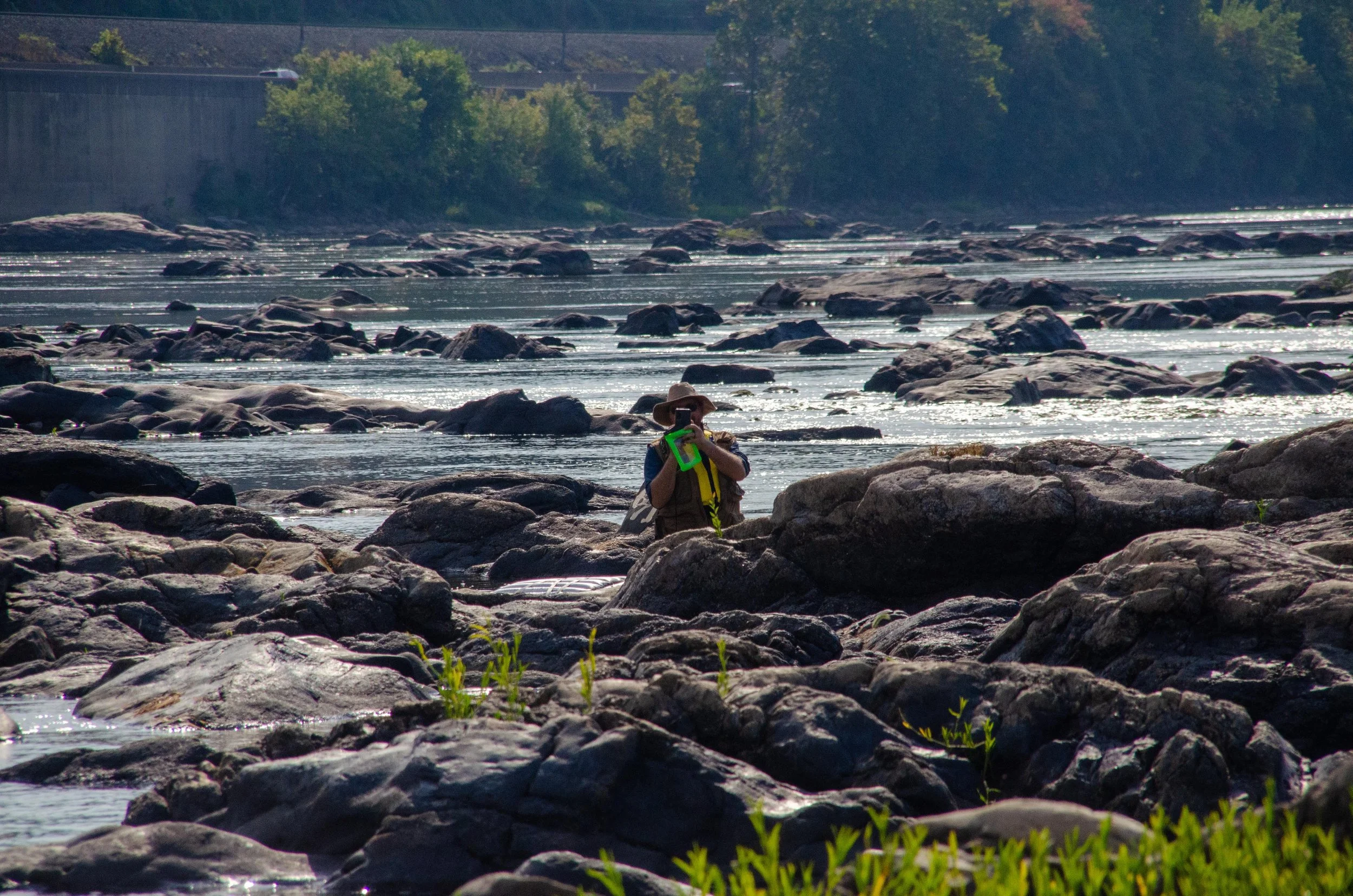
Dauphin Narrows is formed where the river cuts through the Second Mountain (or Cove Mountain depending on who you talk to). Every single source, including our pyro neighbor, advised that we stay to the river left and avoid the worst of the rapids through the narrows. But we had every intention of cutting through the middle, avoiding the right side, and finding the Statue of Liberty replica. Originally appearing overnight in the summer of 1986, the first version of the Statue was made of plywood and recycled Venetian blinds. A more permanent version was made of plywood, fiberglass and steel. Erected in 1997, the current Statue stands 25 feet tall and weighs four tons. The pier on which it stands is 33 feet high, bringing the total height to almost 60 feet.

The top of the Dauphin Narrows was similar to Hunter’s Run with fast water, good drops, and lots of rocks to dodge. But unlike at the gap at Liverpool, the water was navigable. We reached the Statue at 09:40 and found a place to pull the boats up. Greg got out his drone and Ed wandered around to take a few pictures. The sun was out and it was a beautiful morning.


With the drone in the air, Ed turned around to see a green kayak headed down to the next set of rapids.
“Huh. I didn’t even see anyone that close behind us.”
Then a little switch in his brain turned on.
That’s OUR kayak.
With NO ONE IN IT.
HEADED TOWARDS THE RAPIDS.
Ed yelled to Greg. “THE KAYAK!!!!”
From Ed:
A torrent of four-letter words sprung from our lips. There was only one option. I had to go get it. I set the camera down and jumped in Big Yellow. In hindsight, I wish I had taken the trailer off, but it seemed like there wouldn’t be time. I paddled HARD. Harder than I had paddled at all on this trip. I paddled at an Olympian speed and strength, fueled by the fear of losing this kayak. What would my friend say if I lost his kayak downstream? How would I explain that? How would Greg finish out the trip? There were lots of what-ifs, but I just didn’t have time to debate. I had to catch that kayak.
It was at this point that I realized that Greg is now marooned. On an island. No shoes, no phone, no food, no water, no single-shot pistol. He had only a drone, an iPad, and my camera.
I reached the wayward kayak before the top of the next set of rapids. I grabbed it, spun around and tried to paddle back. I wanted to get just a little distance so I could tie off his boat to mine, but I struggled to paddle and the current pulled me backwards into the spray. The boats bounced off rocks and I got turned sideways. This was genuinely scary stuff. This is how people drown. People who are not experienced kayakers. People who take risks. I didn’t want to die on the Susquehanna River at the Dauphin Narrows in the shadow of a replica Statue of Liberty. That’s not how I want to go out.
I managed to break free while still holding on to Greg’s boat. It seemed like I was in that wash for an eternity, but in reality it was probably over in seconds and I found myself in a quiescent area behind some large rocks. I put my newly learned rope tying skills to work and put an arbor knot into both ends of a small rope that was at my feet and paddled upstream to a point where I could beach the boats. I hauled mine almost fully ashore. In my panic, I had not resecured Greg’s solar panel and I was amazed that I didn’t lose it. I climbed the rock and saw Greg across the way.

From Greg:
I yelled to Ed “GO GET IT!!” as I still had the drone in the air and it would take me a minute or two to land it. I watched Ed sprint over the rocks to his kayak and take off. One of our original visions for this trip was to get some drone footage of us paddling down the river together. With the moving water and uneven surfaces of the boats, I never felt comfortable with flying the drone while moving on the water. But there I was standing on land watching my kayak drift downstream and Ed struggling to catch up to it. I decided I might as well take the opportunity to get some footage of one of us paddling. I followed Ed a short distance with the drone. I did another flight around the statue as I waited for Ed to recover my boat. I landed the drone and assessed my situation: barefoot, no phone, and in the middle of a river. After a tense few minutes, I could see Ed poke his head above the rocks just below me downstream.
We waved to each other and laughed because at least we were both alive and we hadn’t lost the kayak. Although we shrugged about what to do next, the answer was obvious: Greg was going to have to wade across.
“How much weight can your drone take?” Ed called across to Greg.
“Not much.”
“Enough to carry an empty dry bag?” Ed was hoping Greg could store the electronic gear in it as he made his traverse.
“I don’t think so. Besides I don’t want to risk it here.”
It took Greg a few minutes to gather everything. He put the iPad inside his vest, secured the case for the drone against him, and attached my camera to a shoulder strap. This would leave his hands free and allow him to catch himself if he needed to. He was going to have to traverse the rapids in what looked like the shallowest, slowest point. Ed watched with bated breath as Greg very carefully made his way across and reached the rocks that Ed was on.

“Well that was almost a disaster right at the end of the trip” Ed remarked as he unloaded his gear.
“Yeah no kidding.”
We made the best of it. We got another drone flight, a few more pictures, a few more laughs, and headed off one more time into the last bit of rapids. Greg was jealous. He had wanted to run those. It was 10:15.
The last stretch into Fort Hunter was uneventful and the adrenaline wore off about half way, making that last half mile seem interminable. The water is very still there and intermittently shallows out suddenly.
We reached the boat launch at 10:45, hauled everything up and started unloading what we could. Greg had cut the bottom of his foot badly on the rocks in the rapids and we worked to patch him up.
With the exception of the boat mishap, we had a great run this morning and @ 3 mph. avg. Would not have made City Island. Another time.
By now, the heat had come up, and the exhaustion had really set in. Ed’s wife arrived at 11:10, we loaded the gear, loaded the boats, and found sustenance before we headed back up Hoover Island. We got to cross the Clark’s Ferry Bridge, saw the glassy waters above Haldeman Island, the shallows at Liverpool, McKee’s Half Falls, and finally reached the launch at Hoover Island. What took 35 minutes to drive had taken us days to cover by boat. We were smelly, tired, and hungry but glad to be headed home.

Hindsight

This was truly an adventure. If you get the opportunity to travel downriver on an overnight trip, we recommend it. Here are some key things we learned from our trip that we’d like to pass on to you if you’re considering a river expedition.
-Do your homework. Although some of the intel that we gathered turned out to be bad or misplaced, we understood our options and had already made contingency plans. Take the time to find out as much as you can about your expected course beforehand. This may include maps, discussions with people who have done it recently, reviewing water level data from the USGS, or in-person scouting trips to landings. Make several itineraries to account for changes. Be sure to communicate your itinerary and other details (type and color of your vessel, designated check-in points and times, etc) to at least one other person to ensure that if something goes awry, someone will come looking for you.
-Travel light. We knew we were taking too much gear. But we didn’t want to be caught out needing something. In the end, some auxiliary equipment turned out to be nothing more than additional ballast or drag (literally in Greg’s case).
-The inflatable cooler was fun in the sense that we got to have some home comforts on the water, but ultimately we’d forgo the cooler next time and subsist on dry goods that can pack into a single boat.
-Speaking to other people during the trip (whether on the water or not), can lead to some valuable intel. People may know which routes are more navigable than others and where the best wildlife is. Strike up a conversation with your fellow travelers to glean the maximum information about the area. Be sure to share your intel with them as well.
-Always wear sunscreen.
-Be willing to accept your limitations. We could have made for Island 82 on our second day. Yes, we would have reached it later than we wanted, but we could have gotten there. Instead, we recognized that we were starting to tire and that we had an opportunity to stay at the campground that had not been on our radar. By cutting our losses, we landed and were able to get a bit more rest than we would have had we gone downstream. Additionally, we were fortunate to get new intel that we would not have received otherwise.
We hope you enjoyed following our journey down the Susquehanna. Stay tuned for more adventures and photo tips.