Iceland: The Golden Circle Part 1 - Þingvellir

Echoes of the high desert.
A shrieking alarm on my watch woke me at 3:50 am and with the bright sun already up I struggled to return to sleep. Breakfast at the apartment consisted of some skyr with oats. The city was still quiet and sleepy when we left, driving north on the Ring Road before turning off to Rt. 36 towards Þingvellir (Thing-vet-leer). The road was empty as it was now Whit Monday, another religious holiday. The landscape here felt incredibly familiar. The basin and range and high-desert country of Eastern Oregon, northwestern Nevada, and southern Idaho are dominated by basalt flows and tall, snow-capped mountains, separated by wide valleys with low scrub. This part of Iceland was the same with basalt plateaus, long talus slopes, and dramatic escarpments; except instead of sagebrush, it was lupine that covered the valley floor. We felt at home.
Before reaching Þingvellir, we made a brief stop at an overlook of Þingvallavatn (thing-vahtla-vahtin). This large lake was formed by glaciers thousands of years ago (read on for more). W.S.C Russell describes it best: “A charming landscape burst suddenly into view. The largest of Icelandic lakes, Þingvallavatn, is spread like a mirror below the bluffs. Its forty square miles of water are enclosed with scenic, basaltic headlands, its surface only broken by two islands, small and extinct craters…Long bands of pearly cloud lay athwart the mountain range while cloud and mountain cone lived doubly in the emerald green.”

A charming landscape.

The Crack at the Edge of North America.
Ok class, a brief (and not expert in any way) history lesson. Settlement of Iceland began in the late 800’s, and by 930 the people living there (mainly Nords and Celts) created the world’s first parliament on a field adjacent to a large basalt outcrop along the Öxará River. The place came to be known as Þingvellir and the chieftains held an annual parliamentary meeting known as the Alþing (pronounced all-thing). The Alþing was held until the late 1800’s when it was moved to Reykjavík.

Þingvellir
What those early settlers meeting in the warm(ish) summer sun didn’t know is that they had also selected a geologically interesting location. Þingvellir sits at the edge of a small micro-plate between the North American and Eurasian plates called Hreppafleki. Here, the movement of the two mega plates created a small rift basin between them, wrenching apart the earth and forming long fissures and canyons on either end of the basin. At Þingvellir, Almannagjá canyon (All-Men’s Rift, named for the common people who stood atop while the nobles met at the AlÞing) forms a robust western wall of the plain. During the last glacial period, a large glacier carved through this area. Its retreat formed the Þingvellvatn lake to the south. Earthquakes are still common here and as the land continues to subside, so does the landscape. The Öxará River has been diverted into the rift and subsequently flooded the Þingvellir plain. Who knows how much history has been buried as the new course of the Öxará has shifted back and forth over the last thousand years.

Raised topographic map of Þingvellir and surrounding area.
As a structural geologist (the kind that likes big faults and tectonic plates) and lover of all things basalt, this place made me giddy as a schoolboy. Here it is! The edge of the North American Plate! I’ve now traversed the breadth of the plate, having visited the margin with the Pacific Plate in California in 2008. Even better was that the margin here in Iceland was marked by big rift faults and beautiful basalt flows in an epic outcrop. Can life get any better than this?

Almannagjá Canyon

West edge of the North American Plate on the San Andreas Fault at Carizo Plain National Monument. 2010.

East edge of the North American Plate in Almannagjá Canyon at Þingvellir National Park. 2025.
While it was windy at the top of the cliff, the valley and the canyon were calm and quiet. We explored the rift and the Öxará river with little to no crowds, just some wagtails, geese, and a redwing or two. The church Þingvallakirkja (thing-valla-keerk-ya) stands on the east side of the marshy wetlands and is typical of the architecture of nearly every Christian church on the island with a classic steeple up front and modest adornments.
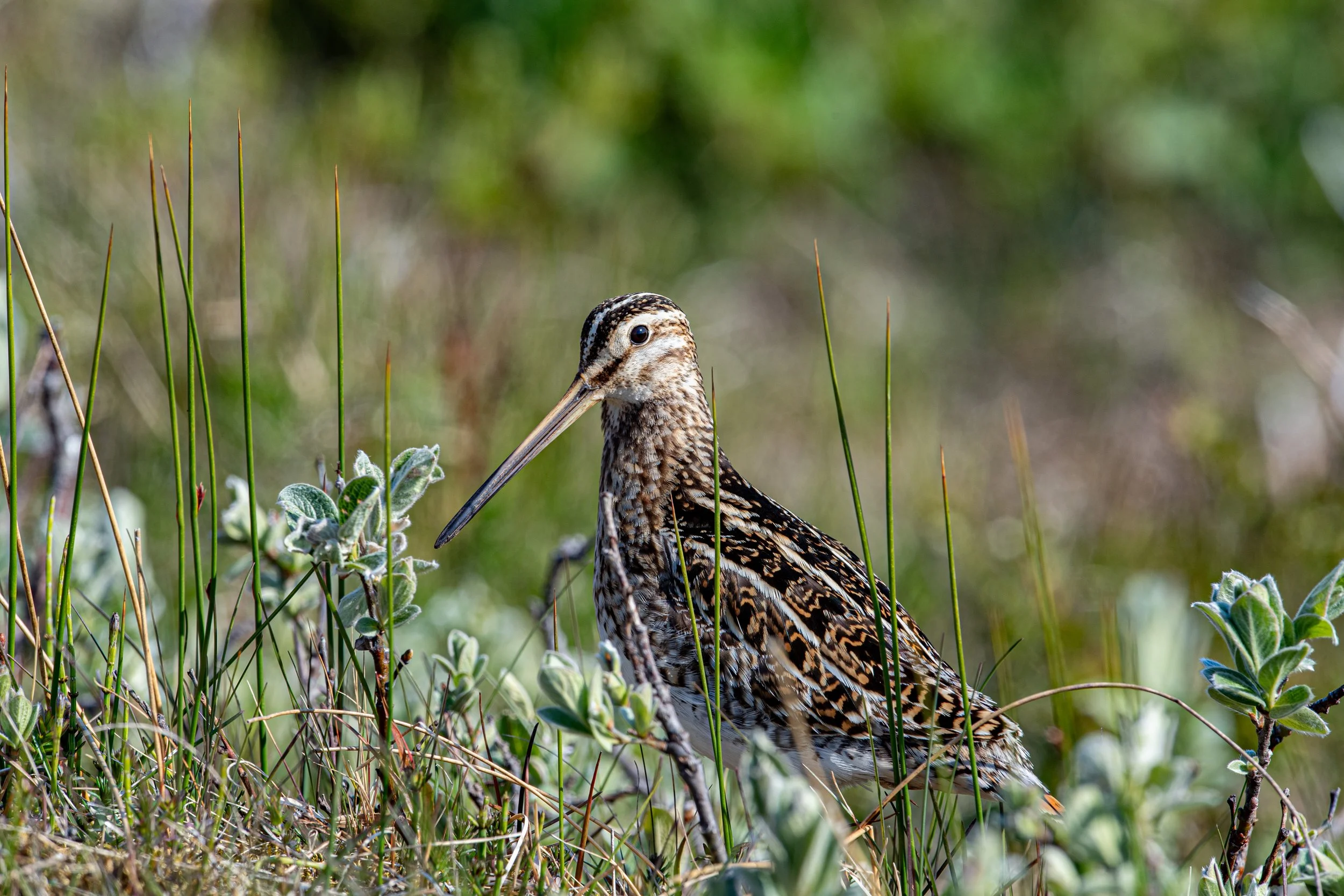
Common Snipe
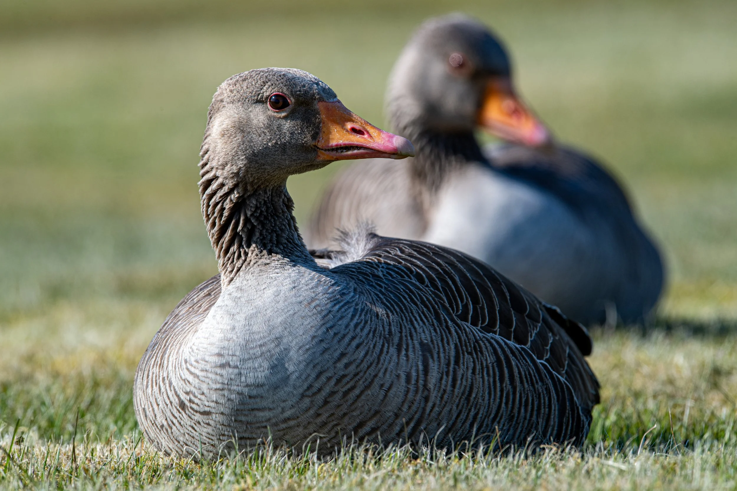
Greylag Geese

Þingvallakirkja

Inside the church
Buses loaded with tourists started pouring out into the park. Our solitude at Þingvellir was over. As we drove around the north side and reached the other side of the rift basin I couldn’t help but think about the thousand years of human history here. For nearly a millennium, every year without fail, the people of what would become Iceland met here to hash out their laws. And it was the geological forces in play for more than 15 millions years that made the site favorable. Those same geological forces are still at work today and are slowly erasing any evidence of our short time here.